PHAiRS Home Page
Converging NASA Mission Measurements and Products with Decision Support Systems to Validate and Benchmark Public Health Medical Alerts and Early Warning Systems
 Most Recent 48-Hour PM 2.5 Dust Animation
|
|
|
 Most Recent 48-Hour PM 10 Dust Animation
|
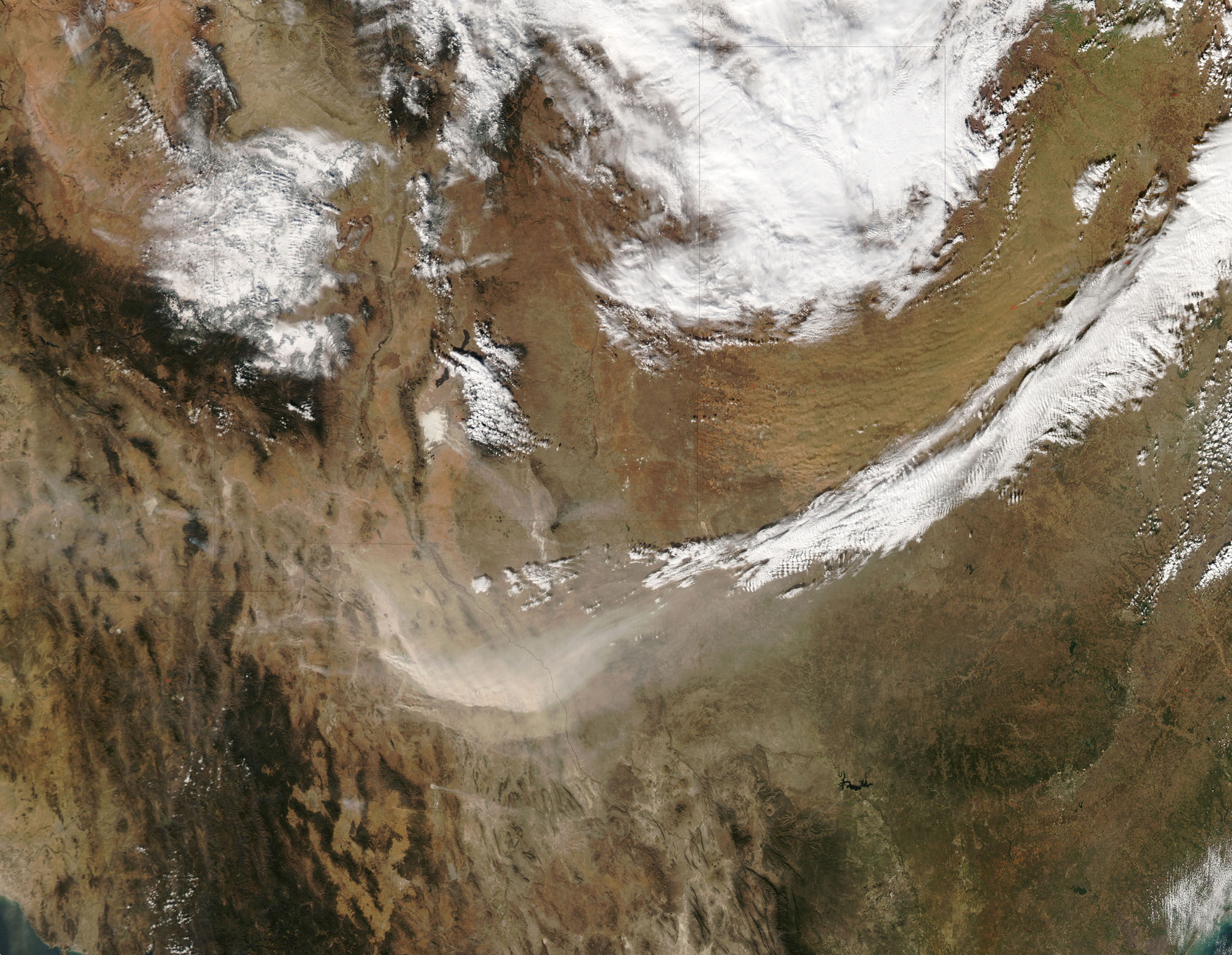
Dust Storm in Texas: The same weather system that brought snow and ice to the American Midwest just after Thanksgiving 2005 also kicked up significant dust in western Texas and eastern Mexico. The winds associated with this cold front also fanned the flames of grass fires in the region, adding smoke to the mixture of aerosols. The Moderate Resolution Imaging Spectroradiometer (MODIS) flying onboard the Aqua satellite captured this image on November 27, 2005. In this image, the most obvious dust cloud is a pale beige dust plume swirling through Texas and Mexico. However, a second, more orange-colored cloud of dust blows across northern Texas. And in New Mexico, a bright white patch of ground—White Sands, New Mexico—is giving off a streamer of dust that blows southeast. According to TimesRecordNews.com, the temperature change from this cold front was extreme, and such big temperature changes often mean severe winds. Parts of northern Texas saw wind speeds around 100 kilometers per hour (60 miles per hour). Resulting dust storms reduced visibility to just 4 kilometers (2.5 miles) in some areas, and swamped local fire departments with calls regarding both fires and downed power lines. NASA image courtesy the MODIS Rapid Response Team at NASA GSFC. The MODIS Rapid Response Team provides daily images of this region. |
Created by
admin
Last modified 2011-07-20 02:01 PM
Last modified 2011-07-20 02:01 PM